
The image below shows Parsons Hill streets and erven (click on the Image to see a LARGE Version).
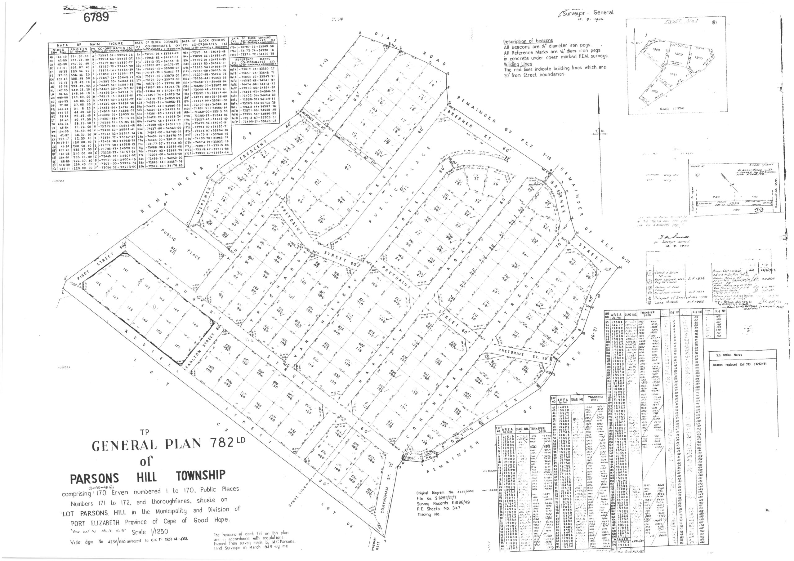
According to the map the following streets form Parsons Hill:
- Diaz Road – Erven 1, 7 and 14
- Brebner Street – South Side Erven
- Wepener Crescent – East Side Erven
- Pigot Street – East Side Erven
- Kestell Street – South Side Erven
- Conyngham Street – From Kestell to Joubert Street – West Side Erven; from Joubert to Brebner Street – West AND East Side Erven
- Joubert Street – Both Sides
- Carlton Street – Both Sides
- Potgieter Street to Brebner – West and East Side Erven
- Pretorious Street – Both Sides
- Hartley Road – Both Sides
- Van Niekerk Street – Both Sides
- Tucker Street – Both Sides
We use this map to determine just who is in Parsons Hill and ‘eligible’ to join our Neighbourhood WhatsApp Group.
The Surveyor General, on 13 September 1950, released the General Plan of Parsons Hill Township.
In the plan above you will see that Parsons Hill consists of 170 Private Erven numbered 1 to 170. Erven 171 and 172 are public spaces.
These erven and beacons are in accordance with regulations framed from the survey done by Land Surveyor Mr M.C. Parsons in March 1949.
NOTE: According to the municipal town planning office the demarcation above is cast in sone for eternity EXCEPT WHEN a consolidation of erven takes place across boundaries.